Rumbling Rabaul – The raging Cauldron of Tavurvur
Rabaul, a settlement in the East of magic exotic Papua New Guinea, has literally one of the hottest chronicles worldwide. On the one hand the equatorial sun is frying everything at temperatures around 30°C and air moisture of ~90%, on the other hand during World War II. Rabaul was caught in the middle when Japanese and US Americans were battling against each other and for dominance in the Pacific Ocean. That’s only the most recent history though. The biggest imminence was and still is the forces of nature as within living memory they ever emerged at that remote spot of our planet. In particular the eastern end of New Britain Island is at the mercy of volcanism and tectonics; there Earth’s most powerful forces are clashing at top speed and get all too often fully unleashed. Earthquakes are a daily occurrence and being powered by a magma chamber located only 3 to 4 kilometres deep, even two fire mountains – Vulcan Crater and the pretty explosive beast of Tavurvur – are letting off their infernal steam. Although this sounds like hell on Earth life, nature and humans are always coming back to this place and in particular wildlife under water could develop to worldwide unique undersea beauty.
The last Air Niugini flight to Rabaul was delayed this particular evening, yet as arranged John waited for the only white man to leave the plane. The forecast was for good weather, although the five cloud layers of the south-east trade winds at these latitudes are always good for a brief, warm but heavy downpour since the tropical archipelago of Papua and New Guinea lies close to the sun-drenched equator, however the enormous water laden clouds which form over the Pacific and are carried by the south-east trade winds also break here. Fortunately the middle of the year isn’t as wet and John could race his minibus over the potholed streets leading from Tokua via Kokopo to Rabaul.
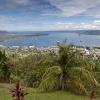
The simplest answer to the question of where on earth this remote area of New Britain is is also the most intelligent: right next to New Ireland. Never let it be said that the guys that named the area didn’t have a sense of humour, as funnily enough both islands situated in eastern Papua New Guinea (PNG) are surrounded by a body of water, the name of which could not be more German and would make every Briton’s stomach turn: Bismarck! The correspondent sea at the eastern end of New Britain, that is the Bismarck Sea, washes around the Gazelle Peninsula and the natural harbour it surrounds, Simpson Harbour.
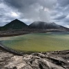
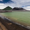
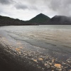
The 14km long and 9km wide bay containing both Simpson Harbour and Blanche Bay is of volcanic origin. This is the Rabaul Caldera (actually the Blanche Bay Caldera Complex), and at the entrance the stratovolcanoes Vulcan Crater and Tavurvur (also known by its old name Ghaie) face off from the promontories on either side of Simpson Harbour like Scylla and Charybdis. Tavurvur in particular, which means “ash spitter” in the language of the Tolai tribe, is a pretty sly old dog…
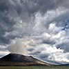
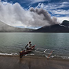
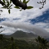
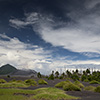
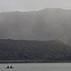
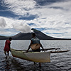
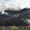
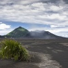
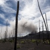
If in the context of volcanoes there is something similar to a moody mother-in-law, then the Tavurvur would do it justice. It should always be approached with due respect, as it continues to send thick ash clouds toward Rabaul and its rebellious outbursts cannot be classified, let alone assessed. Mother-in-laws aside, the volcano presents its most photogenic side in the rays of light of the early morning or the early evening and the light that penetrates the layered clouds produces wonderfully varied light effects; sometimes it even seems that the heavens open to receive Tavurvur’s gas and ash clouds.
The spectacular Rabaul Caldera is also part of the Pacific Ring of Fire which contains 90% of the world’s active volcanoes. It evolved at a point where the earth’s crust was once severely fragmented and where now the shards are clashing at top speed. The caldera lies exactly on the sensitive interface between the northern and southern Bismarck microplates, two tectonic fragments which not only rub against each other but also sit vicelike between the southern Salomon and the enormous eastern Pacific plates. In short; a rather fragile place on the earth’s mantle, the thin skin of which is capable of something a lot more eventful than the local canasta club, the highlight recommended by the tourist centre.
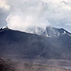
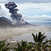
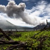
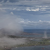
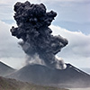
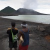
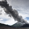
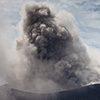
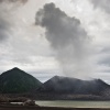
There are moments in life when everything happens except the expected. Starry-eyed, I flew toward Rabaul, lest glowing boulders be flying around in the sky. No chance! Despite its rebellious reputation Tavurvur dozed quietly for most of 2010 and 2011 – very quietly… too quietly. I joked “Oh well; volcanoes usually become active when I turn up somewhere”, and contacted the lads working with Ima Itikarai at Rabaul Volcano Observatory. On Wednesday the 3rd of August 2011 the time had come. The deep boom of the explosion lead me to jokingly ask if the Japanese were attacking again, but then fingers pointed towards the volcano which had just exploded and sent an ash cloud about a kilometre high into the sky.
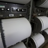
On this particular morning I had actually wanted to film the interaction between the strong winds and the omnipresent ash in time lapse, however instead, true to the motto of “right place, right time”, the camera became a witness to the reawakening. Despite estimated wind speeds of 5-6 the ash cloud did not clear for a good two hours. Just after the eruption, the lads sat analysing data on the computers in the air conditioned seismic room. The seismometer with the abbreviation TAV for Tavurvur never settled, instead showing strong ambient noise, the so-called tremor.
