Mount Ruapehu – Above the Clouds of North New Zealand
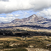
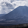
Mount Ruapehu marks the southern end of the Taupo volcanic zone. Together with stunning Tongariro national park it stands for a region that shapes and defines the character of New Zealand’s north island. With an elevation of impressive 2797 metres it is also North New Zealand’s lighthouse, its highest spot; a place easily seen from the far away. Its crater is jagged, dramatic but also accommodates a wonderful crater lake. Volcanically seen Ruapehu is everything but dormant and its eruptions mostly occur without an advance warning. To boot it’s known for ist hot volcanic avalanches, so called lahars.
Actually this story of summiting begins in Paraparaumu, a city having unpronounceable name, being located in the south of North New Zealand. Coming from Picton and the ferry to Wellington I actually wanted to take the ferry from there to Kapiti Island, a bird sanctuary. Since the passage price was gross I skipped my plans and drove on to Tongariro where the sun already exceeded its daily maximum hence starting the time-consuming but very beautiful Tongariro Alpine Crossing was no option that day, also the neighbouring Mount Ruapehu looked more compelling though.
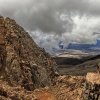
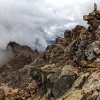
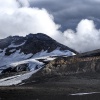
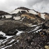
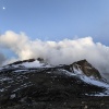
The chair lift helps to cover most of the meters in altitude. Having touched down at ~2000m most of the people only make a call on New Zealand’s highest café instead of heading further. The remaining 800 metres between the chair lift’s final stop and the summit are no mere child’s play though. I love volcanoes, if there only wouldn’t be those climbs and descents… ;-) First you have to slide over glacier polished slippery rock plates, then sticky sand mingled with debris make the climb “unforgettable” but after some time the terrain changes and you hike amidst jagged and razor-sharp volcanic rocks. Every little while clouds push in and shroud the way up to the summit completely and you find yourself walking towards the light at the top of the mountain like a moth to the nightly light post.
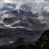
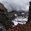
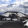
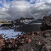
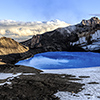
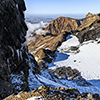
However, after some time I reached the rim of Ruapehu’s glacier-filled crater. Standing on Te Heuheu, a subsidiary summit, a tremendous panorama opens up, reaching from the East to the West, from a jagged escarpment to another, framing a volcanic cauldron being the showdown spot of clouds and sunlight battling each other. Up there you literally stand on the edge of breath-taking little abyss that drops off dramatically making the Earth you stand on fade away under your boots.
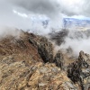
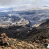
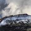
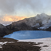
Up there you literally face the whole bandwidth of climatic appearances, ranging from steel-blue sky to thick cloud fronts hiding the rest of the world from your eyes and being whipped through the crater by strong winds interspersed with hail. The afternoon gets older. More and more the sun wins the battle against the clouds and breaks appear letting wonderful sidelight pass through. Its light and shadows illuminate the crater growing between the three summits Tahurangi, Te Heuheu as well as Paretetaitonga marvellously.
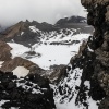
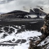
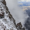
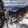
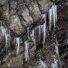
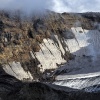
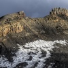
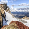
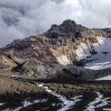
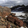
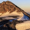
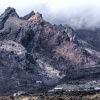
The crater rim escarpments drop off dramatically. Standing on them is an enjoyment with caution as in the afternoon in many places the sun often partially thawed the frost making many places being bloodily slippery or even crumble away under your boots. Already the first escarpment after having reached the summit area offers a terrific view as when watching along the icicled rock face you can see the Taupo valley and the volcano’s heavily eroded eruption slide. Also the so called Cathedral Rocks at the eastern crater rim are impressive and remind of three broken teeth, or pinnacles, or the Dolomites.
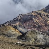
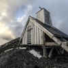
The rocks surrounding me are pretty colourful and remind me of my last year’s excursion to Mutnovsky volcano on Kamchatka. In the far distance one can spot a shelter that looks against the background of dark clouds and steep cliffs even more protective. The crater rim is a large serpentine and leads automatically to the ridge called ‘The Dome’ where the shelter is and maybe it’s even open so I won’t have to put up my tent. Fiddlesticks! Opening the hut’s door is not permitted and will be fined. If at all then this hut may be only opened in case of emergency. Well, the funny thing is that even the staying sane and healthy people are not able to open it. Hence how could someone injured open that thing??? With an axe? Or dynamite? …?
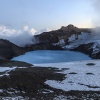
The Dome, that is the hill being crowned with the sheltering hut, is located right next to Ruapehu’s crater lake. From there you can already smell the sulphur being constantly emitted by the lake. Its current status “volcanic unrest” pretty much hits the spot as the bluish shining lake at the southern end of Ruapehu’s three kilometres wide crater is everything but only beautiful. It is the source of hot muddy avalanches, so called lahars when the volcano has hiccups. Lahars are quick, hot and often not pH-neutral. Not to mention the pressure of the material flowing downwards. Back in 1953 a lahar killed 151 people at the Tangiwai train disaster.
Such a hiccup can come out of the blue as it only needs a boost of energy from the Earth’s inward. Rising up magma isn’t even needed too as already good heat conductivity is enough to make things happen. Solidified lava rocks are pretty good at that, only think of the lava stone grill at the steakhouse around the corner. A sequential effect of such a heating-up is that permafrost backs out. At such altitudes permafrost is often the glue making things stick together.
A volcano (like every normal mountain as well) might come apart at the seams ;-) When that happens, also massive scree and debris avalanches rush down to the valley without that magma saw the Earth’s surface. Up-to-date studies take a close look on heat conductivity and invoke evidences how actually dormant volcanoes like Chaiten in Chile are able erupt terribly plinian at any time.
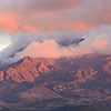
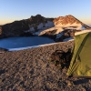
But let’s get back to Ruapehu, where the evening has set in and it is time to put up my tent. The direction of the weather is unmistakable, that is from West to East, hence I put my mobile hideout in the slipstream of the hut. The evening mix between clouds and sidelight from the sun is terrific. Contrasts as well as colours get deeper and stronger, making the background look even more dramatic. An eye-candy par excellence and as photographer you actually only have to release the shutter at the right place as Mother Nature is in charge now to paint the world we know with all potential colours we know.
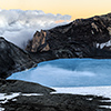
The sun’s residual unveils all kinds of colours crater rocks have on offer and of course sulphuric yellow is in on it as well as many other kinds of metal oxides. Also it’s teasing out the structure of water evaporating from the crater lake, which gets whipped over the surface by the wind as small vapour-made mini tornadoes. The sun continues its descent and compact cumulus clouds start to fly into the crater and fill it. This moment, of fluffy white clouds being in contrast to a gentle orange firmament burns into my mind. But, as soon as the sun totally disappeared temperatures drop significantly.
Actually my plan was to photograph the crater lake at night, at more less full moon and with star trails in the sky but quickly I notice that I have to see my tent and eiderdown sleeping bag very soon as only there I will survive unscathed. The temperature drop is no surprise as Ruapehu stands pretty much exposed on the north island flat land, hence all things called climate blow off their steam when they get stuck at a mountain. People down in the valley have no clue about the things going on up here and darn it, my gut feeling about going inside my tent was right as the clouds sink down to the valley and the summit has no protection anymore. It becomes cold, really cold, if not to say fucking cold… At -12°C and gusts around wind force 7 my breath freezes instantly in my whiskers, also on the tent frame and my glasses.
At regular intervals I create frictional heat with rubbing legs, well actually rubbing the whole body inside the sleeping bag. Fortunately my eiderdown sleeping bag keeps the worst away, if there only wouldn’t be the bloody wind… Despite camping in the slipstream of the hut the wind shakes the whole tent as if a hungry football team wanting to enter a kitchen tries to enter. The wind cools down tent as well as soil insanely and finding sleep is barely possible at background noises like that.
From time to time the crater lake chortles, meaning not such a shallow bubbling but a burp coming from deep inside the mountain, as if your bowels would try to digest the plenty of cabbage you have eaten. To monitor such events the hut has been set up on the hill right next to the lake. It accommodates different kinds of measuring instruments to watch the volcano’s activity from distance. What may those people have thought when I banged in the tent pegs? ^^
After a night of shivering waking sleep I simmer with excitement to see the sun again, not only to photograph the sunrise but much more to feel warm again. I get up and put on five layers: three Merino woollen, one fleece and finally a wind-proof jacket. Yet during the whole morning it is still bloody cold.
However sticking it out the whole night was worth it as the visibility that morning is world-class and I can even see the Mount Taraniki and the coastal area behind it being some 130km away in the distance. Similar visibility and light condition you can only see when travelling on a plane into the sunrise.
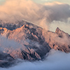
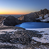
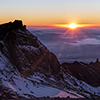
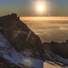
Holy shit, I have never been that happy about seeing our hot central star…! Finally it pushes itself over the horizon sending golden rays of light over the top side of the cloud layer that is now floating some 1500 metres further down. With that reflector now the sun can easily unroll its complete play of contrasts and colours.
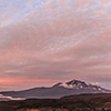
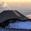
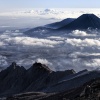
Meanwhile also the summits of neighbouring volcanoes Ngauruhoe and Tongariro peep out of the thick clouds. Watching them yesterday was not possible at all due to the cloud orgy happening around Ruapehu’s summit. A funny thing though is that from the top of Ruapehu, which is higher, the already pretty tall Ngauruhoe appears like a midget. Another great view is to see the countless topographic structures left behind by volcanism from a bird’s perspective. Almost everywhere you can see former cinder cones or small cauldrons.

